The Best Map Apps for Your Korean Adventure
South Korea boasts an impressive public transportation network, and good map apps make it even easier to get around. Whether you're hopping on a bus in Busan or catching a subway in Seoul, these tools have got you covered. This guide will introduce you to the top map applications that'll transform your Korean journey into a seamless adventure.
Naver Map
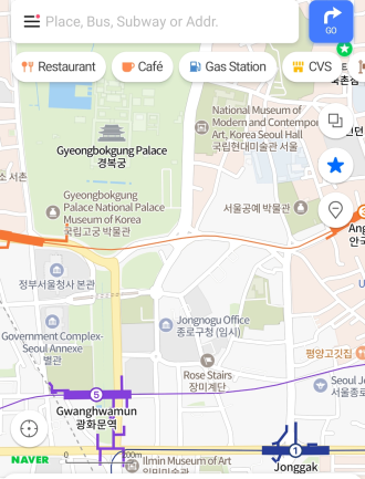
When you're in Korea, Naver Map is like your trusty sidekick. It's the most popular map app, and for good reason! It provides up-to-date bus and subway routes, including real-time arrival information, estimated journey time, and the number of stops. It even offers a handy "first and last train" feature for subway lines, ensuring you never miss your ride.
This feature-packed app is particularly loved for its detailed maps that include tiny alleys and shortcuts. Naver Map also offers 360-degree street views, bus routes, and even indoor maps for certain locations such as shopping malls and airports.
One of the highlights of Naver Map is its "theme" function. This allows you to explore the best places to visit based on different themes like cafes, cherry blossom spots, or night views, making it a great tool for discovering hidden gems.
KakaoMap
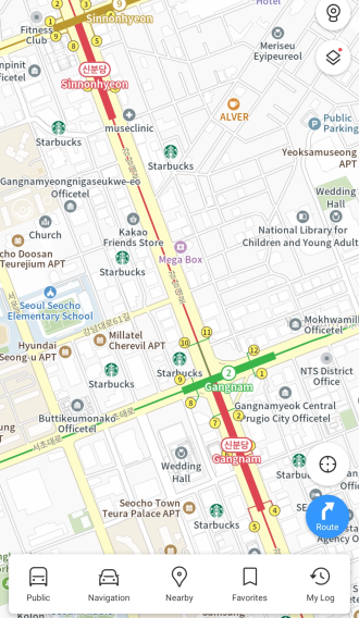
KakaoMap matches up to Naver Map with its extensive public transport navigation features. Known for its accurate directions and user-friendly interface, it's your go-to guide for navigating Korean roads. Be it driving, walking, or public transit routes, KakaoMap has got you covered. The app also features real-time traffic information and estimated travel times, making it easier to plan your journey.
KakaoMap shines with its localized data. From finding the nearest 'Jjimjilbang' (Korean sauna) to the hottest new 'Samgyeopsal' (grilled pork belly) restaurant, it brings local businesses right to your fingertips.
KakaoMap excels when it comes to navigating public transportation. Simply enter your destination, and the app will lay out the fastest routes using buses, trains, and even taxis. It provides detailed information about bus stops, including bus numbers, schedules, and real-time arrivals. The same goes for subway stations – KakaoMap offers comprehensive details about station exit numbers, transfer points, and train schedules.
Google Maps
In Korea, Google Maps may not have as detailed public transit information as KakaoMap or Naver Map apps, but it still serves as a decent guide. It provides directions for buses and trains, with information about stops and schedules. However, it may not be as accurate or up-to-date as KakaoMap or Naver Map.
Closing Remarks: App-tly Navigating Korea
All three of these map apps can be downloaded for free from the Apple App Store and Google Play Store. You may need to adjust the language settings to suit your preferences.
While these map apps are fantastic aids, remember that they're just tools to enhance your journey. Don't be afraid to take a wrong turn or stray from the planned path; sometimes, that's where the best memories are made.
Each app has its strengths and weaknesses, so it might be useful to have more than one installed on your phone. With these apps in your pocket, you're ready to navigate Korea's bustling cities, picturesque countryside, and majestic mountains with confidence.
Technology has made exploring new places easier than ever, and these map apps are testament to that. They bring the farthest corners of Korea to your fingertips, allowing you to chart your own path and explore the country at your own pace. So go ahead, fire up these apps, and let your Korean adventure begin. Happy navigating!


